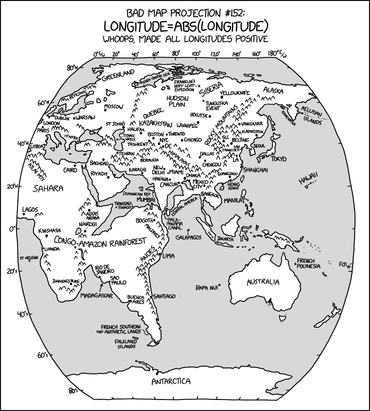
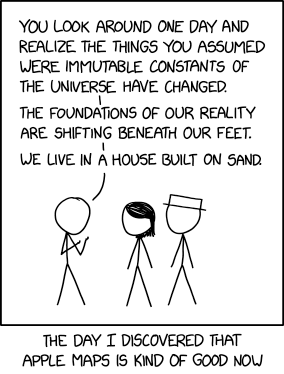
xkcd: All South Americas

Randall Munroe, “Bad Map Projection: South America.” xkcd, 17 Jan 2020.

xkcd is back with another bad map projection: in this one, it’s all South Americas. The alt-text: “The projection does a good job preserving both distance and azimuth, at the cost of really exaggerating how many South Americas there are.”

Previously: xkcd’s Time Zone Map; xkcd’s Liquid Resize Map Projection; xkcd’s United States Map.

Poorly Drawn Lines Maps the Snark

Reza Farazmand, “Welcome,” Poorly Drawn Lines, 16 Aug 2019.

Last month Poorly Drawn Lines, the web comic by Reza Farazmand, published “Welcome,” a comic that with its blank map of the ocean channels Lewis Carroll’s 1876 poen The Hunting of the Snark.

If you’re not familiar with that poem, here’s the key passage:

He had bought a large map representing the sea,
Without the least vestige of land:
And the crew were much pleased when they found it to be
A map they could all understand.

“What’s the good of Mercator’s North Poles and Equators,
Tropics, Zones, and Meridian Lines?”
So the Bellman would cry and the crew would reply
“They are merely conventional signs!

“Other maps are such shapes, with their islands and capes!
But we’ve got our brave Captain to thank:”
(So the crew would protest) “that he’s bought us the best—
A perfect and absolute blank!”

And here’s the accompanying map:

(More at Strange Maps. Source for the above image.)

SMBC’s Alternatives to a Flat Earth

“Flat,” SMBC, 8 Aug 2019.

It’s not like xkcd has a monopoly on comics about maps. Last week, Zach Weinersmith’s Saturday Morning Breakfast Cereal web comic posted a comic about alternative non-spherical Earth theories: everything from a hollow Earth to, well, stranger variations—including a slightly lumpy oblate spheroid Earth, which I frankly find hard to believe in.

The Return of ‘Map Men’

After a hiatus of more than two and a half years, Jay Foreman and Mark Cooper-Jones are back to producing new episodes of Map Men. Back in 2016 I called the series “two silly people being very smart about often-silly cartographical situations” (though I may have gotten that backward). Anyway, they’re back, with episodes on the geological origins of the English-Scottish border and trap streets.

‘Last Week Tonight’ Solves the Missing New Zealand Problem

Last Week Tonight cutout New Zealand mapOn Last Week Tonight’s 17 February episode, host John Oliver took a moment to look at how New Zealand keeps getting left off world mapsthe case of IKEA’s map poster being the most recent example. They are nothing if not helpful: as a solution, the show’s Twitter account has posted a cutout map of New Zealand to print and paste on any map that has left it off.

IKEA’s going to need extra security.

New Zealand media is all over this: New Zealand Herald, RNZTVNZ.

Previously: IKEA Map Poster Omits New Zealand; New Zealand Launches Campaign to Get Itself Back on World Maps; Maps Without New Zealand.

Itchy Feet’s Map of Every European City

Malachi Ray Rempen

The latest cartoon from Itchy Feet, a comic about travel and language by filmmaker Malachi Rempen, is a “Map of Every European City.” In the comments, the cartoonist says, “Having been to every single European city, I can safely say with confidence that they all look exactly like this.” I don’t think he’s wrong.

The Onion: The Cartographers’ Secret Continent

The Onion: World’s Cartographers Continue Living Secret Life of Luxury on Idyllic, Never Disclosed 8th Continent. “‘Ah, yes—this is the life,’ said topographical researcher Garrett Farthing, chuckling to himself as he delicately put the finishing touches on yet another map showing their current location to be an empty stretch of the Pacific Ocean while being fed grapes by a trained monkey from an ultra-docile species found only on their lush, temperate, 3.5-million-square-mile landmass. […] No non-cartographer should ever sully this place with their uncultured presence.” You just had to blab, Onion. [WMS]

ClickHole: 700 Dots on a Map

ClickHole

It’s from 2014, but in the context of dumb viral maps it’s eternally relevant. ClickHoleThe Onion’s clickbait parody: We Put 700 Red Dots on a Map.

The dots don’t represent anything in particular, nor is their number and placement indicative of any kind of data. But when you’re looking at them, all spread out on a map of the United States like that—it’s hard not to be a little blown away.

Seven hundred of them. Seven hundred dots. That’s more than 500 dots—well on the way to 1,000. That could represent 700 people, or crime scenes, or cities. Or something that happens in this country every 20 seconds. These dots could potentially be anything—they’re red dots, so they could definitely mean something bad.

Whatever they might be, there’s no unseeing these dots.

[Cartophilia]

Name a Country, Any Country

Last week, Jimmy Kimmel Live had a skit where they asked passersby to name a country, any country, on a map of the world. The results were predictable—doofs who couldn’t name any country at all, or who thought Africa was a country—and so has been the general reaction. Americans not knowing their geography is a cliché that’s decades old at least. Thing is, the half-dozen or so people being shown aren’t a representative sample: the aim here isn’t a scientific survey, it’s good television. And laughing at idiots counts as good TV in America. In that vein, the kid going all Yakko’s World at the end is an absolutely necessary punchline. [Cartophilia]