Skip to content

The Map Room

  • About
    • Contact
    • FAQ
    • Privacy Policy
    • Reviewing Guidelines
    • Submit a Link
  • Archives
    • Book Reviews, 2006-2011
    • Subject Archives, 2004-2011
  • Books
    • Book Reviews
      • Older Book Reviews
      • Reviewing Guidelines
    • Map Books of 2022
  • Extras
    • Blogroll
    • Fantasy Maps
      • Recent Posts
      • Bibliography
    • Fiction About Maps
    • Publications
  • Subscribe/Follow
  • Support

Tag: flags

xkcd Sabotages Those Flag Maps

Published on 17 October 2021 by Jonathan Crowe
Randall Munroe, “Flag Map Sabotage,” xkcd, 13 Oct 2021.

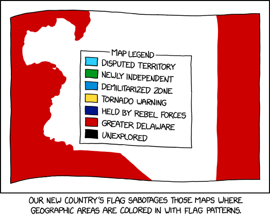
Maps where countries are coloured in with flag patterns: I’ve seen a lot of them around, especially on Reddit, but I haven’t necessarily liked them; xkcd’s comic from last Wednesday goes one step further in that it offers a way to hack them.

Link•Categories Art•Tags comics, flags, fun, funny, xkcd

About The Map Room

The Map Room logoThe Map Room is a blog about maps by Jonathan Crowe. Since 2003 he has covered everything from antique map collecting to the latest in geospatial technology. More about The Map Room.

Subscribe and Follow

  • Email Digest
  • Facebook
  • Mastodon
  • Tumblr
  • Twitter
  • RSS Feed

Support The Map Room

Your support helps keep The Map Room going! You can support me on Ko-Fi or contribute directly to my hosting costs.


Affiliate Disclosure

The Map Room participates in the Amazon, Bookshop and iTunes affiliate programs. I earn income from qualifying purchases made through links on this website.

Archives by Month

Categories

Tags

1500s (43) 1700s (31) 1800s (32) 2016 US elections (29) Apple (44) Apple Maps (62) books (290) California (28) Canada (92) cities (157) climate change (43) comics (29) coronavirus (50) COVID-19 (52) data visualizations (34) disease (42) elections (51) exhibitions (132) fantasy map design (32) fantasy maps (121) funny (64) global warming (33) globes (55) Google (58) Google Maps (92) history of cartography (50) iOS (57) iPhone (40) libraries (122) London (62) map design (42) map projections (47) NASA (59) New York City (37) New York Times (37) pictorial maps (31) railroads (30) railways (30) satellite (29) satellite imagery (45) tube (31) UK (64) USA (174) wildfires (29) xkcd (28)
Privacy & Cookies: This site uses cookies. By continuing to use this website, you agree to their use.
To find out more, including how to control cookies, see here: Cookie Policy
  • Facebook
  • Tumblr
  • Twitter
  • RSS
Proudly powered by WordPress | Theme: Toujours by Automattic.