In Mapping It Out: An Alternative Atlas of Contemporary Cartographies, out now from Thames & Hudson, editor Hans Ulrich Obrist invited contributors “to create a personal map of their own, in whatever form and showing whatever terrain they choose, whether real-world or imaginary.” Examples of the results can be found on the websites of Design Week, FT Magazine and the Guardian; the New Yorker has posted an excerpt from Tom McCarthy’s introduction.
Tag: books
A Book About the Forbes Smiley Affair
In 2005 and 2006 my map blog, The Map Room, was full of posts about one E. Forbes Smiley III, who had been caught stealing rare maps from the Beinecke Library at Yale University. As is often the case with map thieves, Smiley was found to be responsible for many other map thefts from other libraries, and suspected in other thefts. Smiley was sentenced to 30 months in prison. (I posted a lot about the Smiley case: see The Map Room’s Map Thefts category archives.)
I knew there would have to be a book on the Smiley case at some point, and one is coming out next month: The Map Thief, whose author, Michael Blanding, has managed to interview Smiley himself, and promises new information about the case. I’m really looking forward to seeing how well Blanding has managed to tell this particular tale, which consumed so much of my attention seven or eight years ago.
Art and Personal Mapmaking
Two books (well, one is sort of book-ish) related to map art and personal cartography to tell you about:
- Map Art Lab: 52 Exciting Art Explorations in Mapmaking, Imagination, and Travel by Jill K. Berry and Linden McNeilly (Quarry Books, 5/14): “map-related activities set into weekly exercises, beginning with legends and lines, moving through types and styles, and then creating personalized maps that allow you to journey to new worlds.”
- Make Map Art: Creatively Illustrate Your World by Nate Padavick and Salli Swindell (Chronicle Books, 2/14), a “creative toolkit” that includes a booklet and 30 pull-out sheets to use as templates for personal mapmaking projects.
Jill Kelly’s previous work, Personal Geographies: Explorations in Mixed-Media Mapmaking, was reviewed here in 2011 [Fuck Yeah Cartography].
A Book About Globes
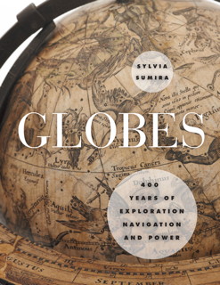
Sylvia Sumira’s forthcoming book on globes—titled Globes: 400 Years of Exploration, Navigation and Power in its U.S. edition and The Art and History of Globes in its British edition—is a history of globemaking during its peak: “Showcasing the impressive collection of globes held by the British Library, Sumira traces the inception and progression of globes during the period in which they were most widely used—from the late fifteenth century to the late nineteenth century—shedding light on their purpose, function, influence, and manufacture, as well as the cartographers, printers, and instrument makers who created them.” Out next month from University of Chicago Press (for North America) and in April from the British Library (Commonwealth markets): Amazon. [Boing Boing]
More Map Books
Here are some map books that I recently found out about:
- Mr. Selden’s Map of China: Decoding the Secrets of a Vanished Cartographer by Timothy Brook (Bloomsbury Press/House of Anansi Press/Profile Books, 9/13). A book-length study of the enigmatic Selden Map of China, donated to the Bodleian Library in 1659 and only rediscovered in 2009. (Amazon)
- The Golden Age of Maritime Maps: When Europe Discovered the World by Catherine Hoffman, Hélène Richard and Emmanuelle Vagnon (Firefly Books, 9/13). One of those big, illustrated books of old maps; this one looks at portolan charts. It’s an English translation of L’Âge d’or des cartes marines. (Amazon)
- Maps of Paradise by Alessandro Scafi (University of Chicago Press, 11/13). Explores “the diverse ways in which scholars and mapmakers from the eighth to the twenty-first century rose to the challenge of identifying the location of paradise on a map, despite the certain knowledge that it was beyond human reach.” (Amazon)
- The International Atlas of Mars Exploration: The First Five Decades, 1953 to 2003 by Philip J. Stooke (Cambridge University Press, 9/12). The first of two volumes (the second will be subtitled Spirit to Curiosity) that maps the extent of exploration by orbiters and landers. (Amazon, author’s page)
Review: A History of the World in Twelve Maps
If somebody who was vaguely interested in maps wanted a book to get them started, I think I might point them toward A History of the World in Twelve Maps, written by Renaissance Studies professor Jerry Brotton. This book first appeared in September 2012 in Great Britain, where it’s now out in paperback. The U.S. edition came out last month in hardcover.
It’s a history of cartography that takes a rather unique approach: instead of providing a straight narrative history, Brotton focuses on twelve maps (or, more precisely, mapmaking endeavours), ranging from Ptolemy’s Geography to Google Earth. But Brotton does a lot more than talk about just twelve maps.
Continue reading “Review: A History of the World in Twelve Maps”
Unfathomable City
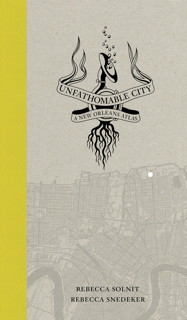
Unfathomable City: A New Orleans Atlas, by Rebecca Solnit and Rebecca Snedeker, came out last month from University of California Press. At first glance it looks like it does for New Orleans what Solnit’s previous work, Infinite City, did for San Francisco: it’s a collection of essays and maps that, as before, displays two complementary or contrasting things on the same city map. In my review of Infinite City I suggested that not every city could sustain a project like this, though San Francisco obviously could; it seems to me that New Orleans is a natural followup.
Earth from Space
Aerial photographer Yann Arthus-Bertrand, author of Earth from Above and related books of photography, ups the altitude somewhat with his new book, Earth from Space, in which he presents and interprets more than 150 satellite photos. Via io9’s holiday gift guide.
Previously: Earth from Above: Yann Arthus-Bertrand Comes to New York.
The Barrington Atlas Comes to the iPad
At a list price of $395, the print version of the Barrington Atlas of the Greek and Roman World (Princeton University Press, 2000), was more expensive than some iPads. Which makes the forthcoming iPad version of the Atlas, described in the announcement as “complete content of the classic reference work,” a veritable bargain at only $20.
In 102 interactive color maps, this app re-creates the entire world of the Greeks and Romans from the British Isles to the Indian subcontinent and deep into North Africa. Unrivaled for range, clarity, and detail, these custom-designed maps return the modern landscape to its ancient appearance, marking ancient names and features in accordance with modern scholarship and archaeological discoveries. Geographically, the maps span the territory of more than seventy-five modern countries. Chronologically, they extend from archaic Greece to the Late Roman Empire.
It’ll be available on November 21: plenty of time for me to get a new iPad Air by then (it works on all iPads except the original).
Previously: Barrington Atlas.
Two Books on WWI Maps

Two forthcoming books that deal with maps of the First World War: Peter Chasseaud’s Mapping the First World War: The Great War Through Maps from 1914-1918, out in a few weeks from Collins; and Simon Forty’s Mapping the First World War: Battlefields of the Great Conflict from Above, out some time next year from Conway Maritime Press.
Sea Monsters and the Carta Marina
It looks like 2013 is the Year of Sea Monsters on Maps. Earlier this year we saw Chet Van Duzer’s Sea Monsters on Medieval and Renaissance Maps (my review); now comes a new study that focuses on a single sixteenth-century map and its many illustrations of seagoing critters: the Carta Marina (1539) by Swedish ecclesiastic Olaus Magnus. Joseph Nigg’s Sea Monsters: The Lore and Legacy of Olaus Magnus’s Marine Map was published last month in the United Kingdom by Ivy Press; in the United States and Canada it’s available from the University of Chicago Press under the title Sea Monsters: A Voyage around the World’s Most Beguiling Map. From the University of Chicago Press page:
Nearly two meters wide in total, the map’s nine wood-block panels comprise the largest and first realistic portrayal of Northern Europe. But in addition to these important geographic elements, Magnus’s map goes beyond cartography to scenes both domestic and mystic. Close to shore, Magnus shows humans interacting with common sea life—boats struggling to stay afloat, merchants trading, children swimming, and fisherman pulling lines. But from the offshore deeps rise some of the most magical and terrifying sea creatures imaginable at the time or thereafter—like sea swine, whales as large as islands, and the Kraken. In this book, Nigg provides a thorough tour of the map’s cartographic details, as well as a colorful look at its unusual pictorial and imaginative elements. He draws on Magnus’s own text to further describe and illuminate the inventive scenes and to flesh out the stories of the monsters.
Close Up at a Distance
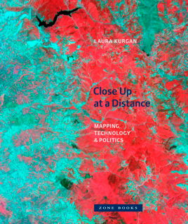
Briefly noted: Laura Kurgan’s Close Up at a Distance: Mapping, Technology, and Politics (Zone Books, March 2013), a different look at maps built with satellite imagery, GIS and GPS data. “Poised at the intersection of art, architecture, activism, and geography, her analysis uncovers the implicit biases of the new views, the means of recording information they present, and the new spaces they have opened up. Her presentation of these maps reclaims, repurposes, and discovers new and even inadvertent uses for them, including documentary, memorial, preservation, interpretation, political, or simply aesthetic.” Via Human Scale Cities.
Review: Sea Monsters on Medieval and Renaissance Maps
Chet Van Duzer’s Sea Monsters on Medieval and Renaissance Maps does what it says on the tin: you really will find out more than you ever wanted to about the sea monsters that appeared on medieval and renaissance maps. (Van Duzer defines them as anything that a contemporary reader would consider exotic, whether it was real or imaginary, so walruses appear along with krakens.) It’s a dizzying catalogue of them, all kinds of them, from medieval mappaemundi (actually, there’s a Roman map in there too) all the way to Ortelius and the late sixteenth century. By the seventeenth century sea monsters were giving way to sailing vessels, and to a loss of ornamentation and illustration in general.
But: sea monsters. What was up with them? For the most part this book gets lost in the weeds, focusing in detail on monster after monster, but Van Duzer does sketch out an argument in the introduction:
First, they may serve as graphic records of literature about sea monsters, indications of possible dangers to sailors — and datapoints in the geography of the marvellous. Second, they may function as decorative elements which enliven the image of the world, suggesting in a general way that the sea can be dangerous, but more emphatically indicating and drawing attention to the vitality of the oceans and the variety of creatures in the world, and to the cartographer’s artistic talents. Of course these two roles are compatible, and sea monsters can play both at the same time. (p. 11)
Van Duzer goes beyond the map in his discussion of sea monsters. For one thing, he points out the non-cartographic sources of sea monsters, such as works of natural history, and compares them to the monsters on the map. He also looks at the economics of sea monsters, which were embellishments that cost extra and may have required a specialist artist: “if the client commissioning the chart did not pay for sea monsters, he or she did not receive them” (p. 10).
For my part, it seems to me that sea monsters in renaissance maps are also holdovers of medieval iconography, sort of a cartographic appendix. Being a big-picture sort, I glazed over a bit at all the detail, but this sort of detail is exactly the sort of thing that illuminates the subject. Between this book and The Art of the Map (reviewed here), I’ve learned quite a bit about the margins and empty spaces of old maps lately.
Previously: Here Be Sea Monsters.
Review: Here Be Dragons
Stefan Ekman’s Here Be Dragons (Wesleyan University Press, February 2013) is a book-length examination of the use of maps and settings in fantasy literature. Maps and settings. Which is to say that maps are not the sole focus of this work: mark that. There are four main chapters, only one of which deals with maps; the remaining three deal with the issue of borders and territories, the relationship between nature and culture in fantasy cities, and the relationship between ruler and realm. Taken as a whole, this book discusses the role of place in fantasy.
But I won’t be discussing that whole here: I am no literary scholar, and can’t say much of value about the chapters that do not discuss maps—nothing that would rise above the level of a last-minute undergraduate paper, anyway. But maps are something I can say something about, especially fantasy maps, since I myself have been paying attention to them over the past decade, first during my time blogging at The Map Room (see the [old] Imaginary Places category) and since then more sporadically, but with more focus, for my fantasy maps project.
Review: The Art of the Map
In The Art of the Map: An Illustrated History of Map Elements and Embellishments, retired history professor Dennis Reinhartz explores the design elements at the margins of western maps from the sixteenth to the nineteenth centuries. It is both a lavishly illustrated book and a close interrogation of the design elements used by western cartographers during the period in question.
From compass roses to cartouches, to sea monsters in the oceans and people and animals in the margins, these elements were used to fill up the otherwise empty corners of a map (of which there were many in this period), set the tone for the map, or otherwise provide information. Most of these elements are gone today (most: National Geographic still makes use of insets and commentaries). Even most fantasy maps, which ape in many ways the maps of this period, may have little more than a cartouche and a compass rose, and are spare in comparison to their historical kin.
Reinhartz organizes his book by elements: ships, sea monsters, plants, animals and people all get their own chapter. With what seems to be a rather small sample of maps, he often returns to the same, familiar maps to discuss a different element. But because The Art of the Map spans more than 300 years, we are not looking at a specific style or usage: the differences between a 16th-century portolan chart and a 19th-century bird’s-eye map of a city are quite substantial.
This book does not make a specific, scholarly argument about these map elements; it’s an appreciation of them, illuminating their essential character by repetitive example. But its intense examination of antique maps’ marginal elements may well open your eyes to, and appreciate, parts of the map that, as present-day readers with present-day map-reading habits, you may well have glossed over.