2016 Holiday Gift Guide: Books

Every year at about this time I post a gift guide that lists some of the noteworthy books about maps that have been published this year. If you have a map-obsessed person in your life and would like to give them something map-related—or you are a map-obsessed person—this guide may give you some ideas.

This year, as you will see, I’ve organized the books by theme: we have five atlases of unusual and non-existent places, several colouring books, and a large number of historical map collections, among other books.

This is by no means a complete list of what’s been published in 2016. The Map Books of 2016 page includes many, many other books that might also suggest themselves as gift possibilities.

Atlases of the Unusual and Non-Existent

Books that call themselves atlases, but really aren’t, are thick on the ground this year: these are illustrated compendiums of fascinating, unusual or simply made-up places around the world. In The Spectator, Alex Burghart looks at three of themAtlas Obscura (which I reviewed here), Edward Brooke-Hitching’s Phantom Atlas, and Travis Elborough’s Atlas of Improbable Places. To which I’d add Aude de Tocqueville’s Atlas of Lost Cities, a catalogue of abandoned places that came out last April, and Malachy Tallack’s Un-Discovered Islands.

Children, crafts and colo(u)ring Books

Colouring books (or, if you’re American, coloring books) have been all the rage lately, and the past year has seen several such books with maps as their subject matter: A-Z Maps came out of the gate early back in October 2015, with Maps: A Colouring Book. Since then, we’ve seen Gretchen Peterson’s City Maps: A Coloring Book for Adults, the Ordnance Survey’s Great British Colouring Map, and the re-emergence of William Hole’s 17th-century illustrations of Michael Drayton’s poetry, repackaged as a 21st-century colouring book called Albion’s Glorious Ile—which is available both as a single volume and pamphlet-sized sections.

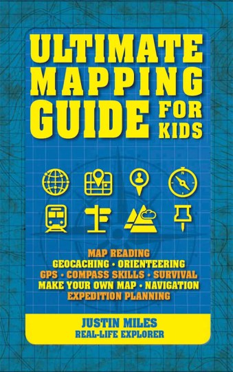
If colouring books aren’t for kids any more, but you’re looking for something child-sized, consider Justin Miles’s Ultimate Mapping Guide for Kids.

If making art is your thing, but you’re not so much about the colouring books, look at Jill Berry’s latest book on personal mapmaking, Making Art From Maps.

Historical Maps

These books explore some aspect of old and historical cartography. (Maps of the 20th Century and Great Britain get their own sections, below.) Cartographic Japan is a collection of essays exploring Japanese maps from the late 1500s. China at the Center (reviewed here) accompanies an exhibition of two pivotal Chinese world maps. Great City Maps collects historical and contemporary city maps. Jeremy Black’s Maps of War is a history of war cartography. Treasures from the Map Room is a diverse sampling of the Bodleian Library’s extensive cartographic holdings (I’m currently working on a review).

The Twentieth Century

Art, marketing and propaganda meet in the 20th Century. Paul Jarvis’s Mapping the Airways draws from the British Airways archives to provide a history of aeronautical cartography. War Map is the companion volume to an exhibition of pictorial conflict maps that wrapped up earlier this month. And speaking of companion volumes, don’t forget the big one: Maps and the 20th Century: Drawing the Line accompanies the British Library’s current map exhibition.

Great Britain in Maps

Old maps of Britain, particularly at the city and county level, continue to find a renewed existence in book form. Birlinn continues its line of regional atlases of historical maps with Oxford: Mapping the City and Scotland: Mapping the Islands. Also seeing print this year was Somerset Mapped and a reprint collection of John Speed’s county maps called Britain’s Tudor Maps.

New York, New York: Maps and the City

New York City is the subject of two new books in which art, story and cartography intersect: Katherine Harmon’s third volume of map art, You Are Here: NYC: Mapping the Soul of the City; and Rebecca Solnit’s third city atlas, Nonstop Metropolis. (A review of You Are Here: NYC is forthcoming.)

Data into Maps

Where the Animals Go provides beautiful maps of animal tracking data, People and Places is a human atlas of the United Kingdom, and Speaking American maps the American vernacular: “who says what, and where they say it.”

World Atlases

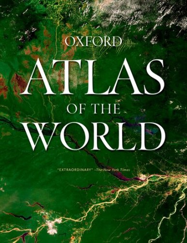
When it comes to big, satisfying world atlases, the most recent to come out are the Oxford Atlas of the World, which is updated every year, and the Times Concise Atlas of the World. The Concise is the second-largest of the Times world atlases: see the comparative chart. (The largest atlases—the Times Comprehensive and the National Geographic—were last revised in 2014.)

(Links go to Amazon. If you buy something, I get a cut.)

Where the Animals Go

where-the-animals-go-excerpt
From James Cheshire and Oliver Uberti, Where the Animals Go (Particular Books, 2016), pp. 100-101.

Co-authored by James Cheshire and Oliver Uberti, Where the Animals Go: Tracking Wildlife with Technology in 50 Maps and Graphics (Particular Books, 2016) is a book of maps by wild animals. It’s a compendium of tracking data from field biologists’ research projects, ably curated and turned into some spectacular maps (if the excerpts on the authors’ website are any indication). Greg has written a piece at All Over the Map.

where-the-animals-goWhere the Animals Go is available now in the U.K.; the U.S. edition comes out in September 2017.

Cheshire and Uberti first teamed up to produce London: The Information Capital (2014), which should be out in paperback any time now.

The Phantom Atlas

phantom-atlasEdward Brooke-Hitching’s new book, The Phantom Atlas: The Greatest Myths, Lies and Blunders on Maps (Simon & Schuster UK, November) is a book about fictitious and erroneous places that were presented on maps as real—“non-existent islands, invented mountain ranges, mythical civilisations and other fictitious geography.” Places like the Mountains of Kong, or the open ocean at the North Pole, or California as an island. Both the Economist’s 1843 Magazine and the Guardian have excerpts and examples from the book.

The hardcover seems to be available only in the U.K. right now, or through third-party resellers on Amazon. The ebook, however, is more widely available: here are links for the Kindle and iBooks. [Ian McDonald/WMS]

Related: Map Books of 2016.

Atlas of Design, Volume 3

The third volume of the Atlas of Design is now available for pre-order and will ship some time this month. The Atlas’s 32 maps are listed here; Wired’s report has a gallery of some of them. At least one or two will probably look familiar to my regular readers. Published by the North American Cartographic Information Society (NACIS), the 98-page book costs $35 (with a 25 percent discount for NACIS members like me).

The Un-Discovered Islands Reviewed

undiscovered-islandsThe Spectator reviews Malachy Tallack’s new book, The Un-Discovered Islands. “This book is an account of 24 non-existent islands, yet is suffused with the same elegiac frostiness as before. Tallack’s style is precise without being perjink, and the overwhelming feeling is of something lost, or disappearing. It’s just this time, what is lost never was.” [WMS]

Previously: Mapping Scottish and/or Nonexistent Islands.

The Bunting Quest

bunting-questAustralian writer Steven Marcuson’s novel, The Bunting Quest, uses a 1581 world map by Heinrich Bünting, and the appearance thereon of what appears to be the west coast of Australia decades before its discovery, as a plot McGuffin: “Nick Lawrance, an antique map dealer, is shocked to find his gallery has been burgled. However, this isn’t an ordinary robbery: the thieves have ignored priceless maps and have only taken Bunting’s World Map. All of a sudden, Nick is thrown into a four-hundred-year religious mystery where strange people around him will do anything for this map … even kill for it. Nick has to figure out why, before it’s too late.” Available in Australia from Hybrid Publishers and for the Kindle and iBooks worldwide. [WMS]

With all the new books coming to my attention in recent weeks, it’s taken me a while to update the Map Books of 2016 page, but I’ve finally done so.

I’m also beginning to hear about books coming out in 2017, so it’s not too early for me to start working on the Map Books of 2017 page.

Some of you may have noticed the bestseller list on the sidebar of The Map Room’s home page (if you’re browsing on a mobile device, it’s at the bottom of the page). It’s based on Amazon and iBooks affiliate sales via this website over the previous three full months: right now it covers August through October; on December 1st I’ll drop August and add November, and so on.

You Are Here: NYC

you-are-here-nycToday is the publication date for Katharine Harmon’s latest book of map art: You Are Here: NYC: Mapping the Soul of the City (Princeton Architectural Press). This is Harmon’s third map art book and features some two hundred maps of New York City, “charting every inch and facet of the five boroughs, depicting New Yorks of past and present, and a city that never was.” Fast Company Co.Design’s Meg Miller has a piece on the book. [via]

Previously: A Forthcoming Map Art Book About New York City.

Mount Buggery to Nowhere Else: A Book on Australian Toponyms

mount-buggeryA decade ago Mark Monmonier published From Squaw Tit to Whorehouse Meadow, the definitive treatment on toponyms and the controversies behind naming places (here’s my review). Now we have an Australian entry: Eamon Evans’s Mount Buggery to Nowhere Else: The Stories Behind Australia’s Weird and Wonderful Place Names, which came out last week. The book, Joshua Nash reports for Australia’s Special Broadcasting Service, “charts place names from the serious – the many names for Australia, for example—to the jocular, like Australia’s many rude and dirty topographic monikers.”

Many of Evans’s humorous stories go a way to responding to some of the scientific inadequacies and toponymic foibles so common in place naming studies. And after I’ve spent almost a decade inundated with often sterile and uninspirational place name theory and how it may fit within more general research in onomastics, the study of proper names, Evans’s tongue-in-cheek take is more than welcome.

I get the distinct impression that this is a less-serious work of scholarship than Monmonier’s. [WMS]

Speaking American

speaking-americanBased on an interactive dialect quiz in the New York Times that generated more than 350,000 responses, Josh Katz’s Speaking American: How Y’all, Youse, and You Guys Talk: A Visual Guide “offers a visual atlas of the American vernacular—who says what, and where they say it—revealing the history of our nation, our regions, and our language.” Out now from Houghton Mifflin HarcourtBuy at Amazon.

Mapping Scottish and/or Nonexistent Islands

scotland-mapping-islandsThe Scotsman’s review of Scotland: Mapping the Islands  focuses on the Scottish islands that didn’t exist, particularly in a 1560 map by Italian mapmaker Giorgio Sideri (aka Callapoda). On the other hand: “In contrast to Callapoda’s chart, many genuine Scottish islands were omitted from maps of Scotland altogether until only 150 years ago.” [Tony Campbell]

undiscovered-islandsSpeaking of islands that didn’t exist, and maps thereof, there’s a new book about them. The Un-Discovered Islands by Malachy Tallack (Birlinn, October). “Gathered in the book are two dozen islands once believed to be real but no longer on the map. These are the products of imagination, deception and simple human error. They are phantoms and fakes: an archipelago of ex-isles and forgotten lands.” Available in the U.K. for now (or via third-party sellers); the Shetland News story about the book suggests that a U.S. edition is forthcoming. Official website. [WMS]

Previously: New Map Books for October 2016.

The Map That Came to Life

the-map-that-came-to-life

As part of National Map Reading Week, the British Library’s map blog points to at least one example of how map reading used to be taught.

One of the most celebrated 20th century children’s map reading guides is showcased in our forthcoming exhibition Maps and the 20th Century: Drawing the Line. Published in 1948, Ronald Lampitt and James Deverson’s The Map that Came to Life follows the story of John and Joanna who use an Ordnance Survey map to walk to town. As they pass over fields, past houses and along footpaths, their surroundings are compared with map adjacent on the same page. The fields turn into contoured blank spaces, houses become black cubes, footpaths dashed lines. Map literacy is acquired by the reader as they accompany the children on their virtual journey, matching map with reality.

In The Map that Came to Life the map is portrayed as an objective, precise and above all truthful mirror of nature. And this inherent trustworthiness enabled maps to become important features of the lives of successive generations of people.

The idea that maps are objective and truthful is not something that would fly today, I think, but in the context of entry-level map education, which in Britain always seems to be specifically in terms of how to read an Ordnance Survey map, rather than maps in general, it seems harmless enough.

A complete scan of the book is available on this website. Back in 2008, Philip Wilkinson talked about the book on the English Buildings blog.

A Historical Atlas of Tibet

historical-atlas-tibetKarl E. Ryavec’s Historical Atlas of Tibet (University of Chicago Press, May 2015) was reviewed in India Today by an unusual personage: Nirupama Rao, who among other things has served as India’s ambassador to China and the U.S. Rao calls it “a much-needed and welcome work of scholarship that should benefit and enlighten committed scholars and Tibet aficionados alike. This is a 200-page atlas that is a revelation in itself.” [Tony Campbell]

Atlas of Improbable Places

atlas-improbable-placesTravis Elborough’s Atlas of Improbable Places: A Journey to the World’s Most Unusual Corners came out last month from Aurum Press. The maps are by Alan Horsfield. “With beautiful maps and stunning photography illustrating each destination, Atlas of Improbable Places is a fascinating voyage to the world’s most incredible destinations. As the Island of Dolls and the hauntingly titled Door to Hell—an inextinguishable fire pit—attest, mystery is never far away.”

This appears to be another entry in the curated-collection-of-unusual-places genre, typified by such books as Atlas Obscura (my review), the Atlas of Remote Islands, the Atlas of Cursed Places (my review) or Unruly Places/Off the Map (my review).

Related: Map Books of 2016.

Nonstop Metropolis: A New York City Atlas

nonstop-metropolisAnother book coming out this month: Nonstop Metropolis: A New York City Atlas by Rebecca Solnit and Joshua Jelly-Shapiro (University of California Press, 19 October). It’s the third and apparently final book in a series of city atlases authored or co-authored by Solnit — you may remember Infinite City: A San Francisco Atlas (2010) or Unfathomable City: A New Orleans Atlas (2013). If you do, you’ll have some idea of what Nonstop Metropolis is likely to be about. Curbed New York’s Nathan Kensinger has a piece on it, in case you don’t. [MAPS-L]