
Over at GeoLounge, Caitlin has a brief and basic overview of medieval maps and travel guides, including T-O maps, travel guides for pilgrims, mappae mundi, and portolan charts. As she points out, only the last of these even attempted to be geographically accurate; the others had other purposes.


The Map Books of 2019 page lists all the books scheduled to come out this year—at least the ones I’m aware of. If there’s a book coming out in 2019 that should be on this page, let me know.
So far there are not many books listed, but that will change as the year progresses. Also keep in mind that publication dates shift all the time: keeping on top of those changes can be a sisyphean task, but I’ll do my best.
All Over the Map
 What works online does not necessarily translate very well into a book, but All Over the Map: A Cartographic Odyssey (National Geographic, October), a very fine book from our friends Betsy Mason and Greg Miller, is strong evidence to the contrary.
For the last two and a half years, Betsy and Greg have written a blog of the same name for National Geographic; from 2013 to 2015 they did the same thing with Map Lab, a map blog for Wired. Their background with regard to maps is similar to mine: “We are not experts in cartography or its history; we’re journalists with a lifelong love of maps who were eager to learn more,” they write in the book’s introduction.
The Times Comprehensive Atlas of the World, 15th Edition
 How exactly do you review an atlas?
The Times Comprehensive Atlas of the World (HarperCollins) is the flagship of the Times World Atlas line. (The others, in descending order of size and price, are the Concise, the Universal, the Reference, the Desktop and the Mini.)1 It’s the latest in a long line of Times atlases, tracing its heritage to the original 1895 atlas published by the Times and the 1922 Times Survey Atlas of the World produced by the venerable Scottish mapmaking firm, John Bartholomew and Son. Like its predecessors, it’s absolutely gargantuan: with the slipcase, it’s 47 × 32.5 cm (16.5 × 12.8 inches) in size and weighs 5.7 kg (12.6 lb). Only the National Geographic Atlas of the World is a little bit larger, and even it weighs less than the Comprehensive (4.5 kg or 9.9 lb).2
The 15th edition of the Times Comprehensive Atlas came out on 6 September 2018 (and on 15 November 2018 in North America). HarperCollins has sent me a review copy, and I’ve been trying to come up with something to say about it.
Continue reading “The Times Comprehensive Atlas of the World, 15th Edition”
New York Times: How Location Data Is Gathered, Shared and Sold
A long exposé from the New York Times explores just how much location data is collected from mobile apps, to the point where the identity of an anonymous user can be reconstructed from where they’ve been. The key point: whatever purpose the app is collecting your location for (for example, to give you your local weather), that location data may be shared with and sold to other parties.
Crowdfunding a Book of James Niehues’s Ski Resort Art

We’ve talked about James Niehues before: the legendary artist has painted hundreds of maps of ski resorts and recreational areas since the late 1980s. I was excited to learn that he’s producing a coffee table book that includes all of his maps. It’s being crowdfunded on Kickstarter. Pledging $75 or more gets you a copy of the book; other pledge levels get you a high-quality print. Clearly there’s some interest: at the moment the project has raised more than $223,000 from nearly 2,000 backers, 28 times its target of $8,000, with three weeks still to go. [Kottke]
Previously: A Video Profile of James Niehues, Ski Resort Map Artist; James Niehues Passes the Torch; James Niehues’s Ski Resort Maps; James Niehues Profile.
Blame the Mercator Projection
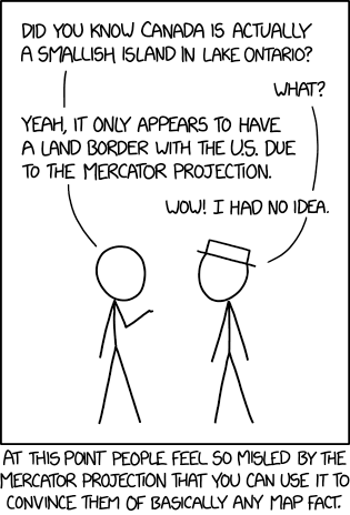
Last Friday’s xkcd suggests that the Mercator projection’s reputation can be used to convince anyone of any false geographical fact.
Not that I’d suggest you do that, mind. No.
DIY Map Ornaments

Meanwhile, Caitlin has a roundup of guides to making your own map-based Christmas ornaments. They include John Nelson’s printable geodesic globe ornament, a decoupage ornament made by gluing map cutouts onto a round ornament, and ornaments made by recycling old maps.
Previously: Waldseemüller Globe Ornament.
Map Gifts for Children
On The Map Room’s Facebook page I was asked, in the context of this year’s gift guide, whether I had any suggestions for younger readers. All I could come up with was The Ultimate Mapping Guide for Kids. Writing in the Guardian, Vivien Godfrey of Stanfords does rather better than I did, providing a list of maps, books, games and puzzles for children. Very much British-focused. [WMS]
Grand Canyon Mapping Conference and Competition
The Mapping Grand Canyon Conference, to be held at Arizona State University from 28 February to 1 March, 2019, “explores the art, science, and practice of Grand Canyon cartography. […] Free and open to all, the conference promises a full two-day program of map-based story-telling, transdisciplinary analysis, state-of-the-art geospatial and cartographic demonstrations, engaging hands-on activities, and open community dialogue.”
The conference also includes a Grand Canyon map competition. Open to students, the competition seeks entries in three categories: artistic map, data driven map (static) and data-driven map (dynamic). Deadline is 20 January 2019. [NACIS]
Popular Mechanics Proselytizes Paper Maps
Popular Mechanics: “Even in 2019, there are good reasons to own a paper map, whether it’s the kind you can grab at the gas station or a sturdy road atlas […] that lives in your car.” This is a listicle, so six reasons are given, some of which are absolute rubbish: paper maps aren’t “nearly flawless” in terms of accuracy (they do go out of date), and they’re not inherently more comparative (checking vs. online maps) than checking one online map against another (e.g. Google vs. Apple vs. OpenStreetMap). Valid points about reliability and being able to plot out your own routes, though. [CCA]
The Writer’s Map
 My review of The Writer’s Map: An Atlas of Imaginary Lands went live today on Tor.com.
Edited by the historian of exploration Huw Lewis-Jones, The Writer’s Map is a collection of essays and maps that explore the relationship between maps and stories; the essays are written both by the creators of those stories—Cressida Cowell, Lev Grossman, Frances Hardinge, David Mitchell and Philip Pullman make appearances—and by the mapmakers who were inspired by those stories, such as Roland Chambers, Daniel Reeve and others. It also draws an important connection between travel and adventure stories of the past and modern fantasy, and explains why “here be dragons” is as much an attractant as it is a warning. Read my review.
The Writer’s Map is published by Thames and Hudson in the U.K. and by the University of Chicago Press in North America, from which I received a review copy.
Previously: More from (and on) The Writer’s Map; David Mitchell on Starting with a Map; Essays on Literary Maps: Treasure Island, Moominland and the Marauder’s Map.

2018 Holiday Gift Guide
Every year at about this time I post a gift guide that lists some of the noteworthy books about maps that have been published this year. If you have a map-obsessed person in your life and would like to give them something map-related—or you are a map-obsessed person and would your broad hints to have a link—this guide may give you some ideas.
A total of 17 books are included in this year’s guide, loosely organized by theme. The focus is on books that are visual and of interest to the general reader;3 this does not even try to be a complete list of what’s been published this year. For that, check out the Map Books of 2018 page, which may suggest other gift ideas to you.
Creative Cartography: Making Art with Discarded Maps

Creative Cartography: Since 2014, students of Ellen Meissinger’s Art on Paper class at Arizona State University have taken discarded maps from ASU Library’s Map and Geospatial Hub and put them to use as raw material for art projects. Every year since then those projects have been the subject of an exhibition hosted by the Map and Geospatial Hub: this year’s exhibition, Place and Space, opened on 7 November and runs until the 26th. (That’s next Monday. Get a move on.) [WMS]
Fake Britain: A Map of Fictional Locations

Londonist’s Fake Britain map: “We’ve put together a map of fictional locations from film, TV, literature and other sources. Take a look around this alternative nation and see how many places you recognise. From Judge Dredd to Vanity Fair, it’s all here.
“The vast majority of entries are well defined geographically. Some—such as Beanotown and Blackadder’s Dunny on the Wold—are a little more nebulous, but we’ve added them for fun. Hogwarts is an unmappable location (unless it’s a Marauder’s Map you’re looking at), but we’ve had a go anyway.”
They’re looking for additions and corrections to the map: this is a work in progress. [Scarfolk]