
 Another look at Plotted: A Literary Atlas (Zest, October 2015) a collection of maps of literary worlds by Andrew DeGraff (whose work is quite distinctive and unique), this time from Atlas Obscura (and focusing on his map for Madeleine L’Engle’s A Wrinkle in Time). Previously. Amazon (Canada, U.K.) | iBooks
Category: Maps and Literature
Three Fantasy Authors Talk About Maps
 Seth Dickinson’s debut fantasy novel, The Traitor Baru Cormorant (which by the way is an amazing book that I recommend wholeheartedly) contains a map unlike your typical fantasy map: it includes annotations by the protagonist that conceal as much as they reveal, and reveal more about the protagonist than they do the geography. In a post on Omnivoracious last October, Dickinson explained how that map came into being.
In Rosemary Kirstein’s Steerswoman series (which has been recommended to me), the scope of the maps broadens book by book as the protagonist’s horizons expands. Today she talked about working with the map (now in digital form) as she writes book five of the series.
 Fran Wilde’s debut novel Updraft (which I’ve heard great things about and should read soon) came out last September. Yesterday, in a blog post called “A Map Year,” she ruminated on the many ways an author encounters maps, in fiction and in real life, and as a metaphor for growth and creativity.
Literary Selections on Cartography
Literary Selections on Cartography was a series of letterpress broadsheets published by the History of Cartography project. A total of 23 appeared between 1992 and 2015; they included poetry and snippets from longer works, and were sometimes accompanied by commentaries. The move of Silver Buckle Press from the University of Wisconsin—Madison to the Hamilton Wood Type & Printing Museum will put an end to any future Literary Selections, in letterpress form at least, but the complete set so far is available online. [via]
Previously: Maps and Poetry.
Fictional Maps International Conference
The Fictional Maps International Conference, which I mentioned on my personal blog last August, takes place next weekend in Katowice, Poland. Of course I can’t be there. But the conference program is now online; abstracts are also available in this ebook.
Mapping The Drowning Eyes


To mark the publication this week of a new fantasy novella, The Drowning Eyes by Emily Foster, the artist hired to create the map, Tim Paul, wrote an essay on how he did it. I’m struck by the lengths he took to “avoid making the map look too European” and by the careful consideration of what a map from that world should look like, which is almost unheard of in the fantasy map business, where maps invariably conform to a very specific style. The end result is a map that evokes portolan charts, replete with windrose lines and looking like it was drawn on vellum. As fantasy maps go, it’s one of the finer executions I’ve seen.
Amazon: paperback (Canada, U.K.), Kindle (Canada, U.K.) | iBooks
For the audiobook version (Amazon, iTunes), the publisher has taken the map and made it interactive: clicking on a location gives you an excerpt from the book. It might not quite be “[the] newest in map technology” but it’s a small and interesting innovation as far as fantasy maps are concerned.
Pocket Atlas of Remote Islands
 Judith Schalansky’s Atlas of Remote Islands first appeared (in English translation) in 2010. Since then it seems to have achieved a longevity few books of any sort manage. A pocket edition came out in 2014. On Wikipedia (of all places) there’s a companion to the book, linking to entries for each of the Atlas’s essays. And just last week it was featured on The Paris Review’s blog. (See also this 2013 interview with Schalansky at, appropriately enough, The Island Review.) Buy at Amazon (Canada, U.K.)
Book Riot on Fantasy Maps
This Book Riot piece on fantasy maps from last September touches on a number of subjects I can never get enough information on: the editorial decision on whether to include a map, how one becomes a fantasy map maker, what information from the author does the map maker have to work with, how the maps are created. Practical subjects, in other words. Includes quotes from two people in publishing and two map makers: Tim Paul and Rhys Davies. [via]
Previously: Robert Lazzaretti, Fantasy Mapmaker; Mapping An Ember in the Ashes; How to Make a Fantasy Map.
The Weight of Imaginary Geography
Susan Dennard: “Because I’m currently writing the second book in the Witchlands series (titled Windwitch), I thought I’d discuss maps. Why? Because maps are really, really important in storytelling. I don’t care what genre you’re writing—knowing Where Things Are not only helps the drafting process, but it also helps ground the story.”
Maps and Poetry
I’m not alone in looking at the use of maps in fantasy literature; Hunter College classics professor Adele Haft, on the other hand, has been studying something a bit more singular: the use of maps in modern poetry. According to her CV she’s published a number of papers on poems like “The Map” by Elizabeth Bishop; more recently she’s been publishing, in Cartographic Perspectives, a multi-part study of Australian poet Kenneth Slessor’s poetic sequence The Atlas: introduction, part one, part two, part three, part four.
Map of Middle-earth, Annotated by Tolkien Himself, Discovered

A map of Middle-earth annotated by J. R. R. Tolkien has been found. The map, found among the papers of illustrator Pauline Baynes, who died in 2008, was used by Baynes while she worked on a full-colour map of Middle-earth published in 1970. Tolkien’s annotations appear on the map in green ink and pencil; they not only correct some of the errors of the original map (executed by his son, Christopher); they also offer some geographical parallels to our own world (Hobbiton is at the same latitude as Oxford, Minas Tirith at Ravenna’s). Blackwell’s Rare Books is selling the map for £60,000; it’s the centrepiece of a forthcoming catalogue on the work of Pauline Baynes. [Tor.com]
The Art of The Lord of the Rings
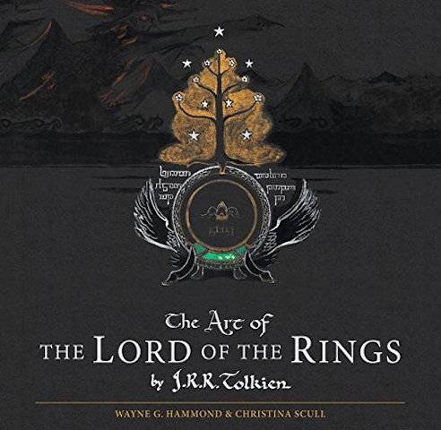 When J. R. R. Tolkien was writing The Lord of the Rings, the map was not an afterthought. (For one thing, with characters travelling many miles over many months, separately and together, distances and dates had to add up.) Tolkien didn’t just draft; he drew—maps, sketches, drawings, whatever he needed to help him visualize the world he was inventing. About 180 of those maps and drawings are now collected in a new book out today: The Art of The Lord of the Rings, edited by Wayne G. Hammond and Christina Scull (who previously authored The Lord of the Rings: A Reader’s Companion). Wired has some sample images. (From what I can tell, the British edition is slipcased.) [Boing Boing/MetaFilter]
A Fantasy Map Roundup
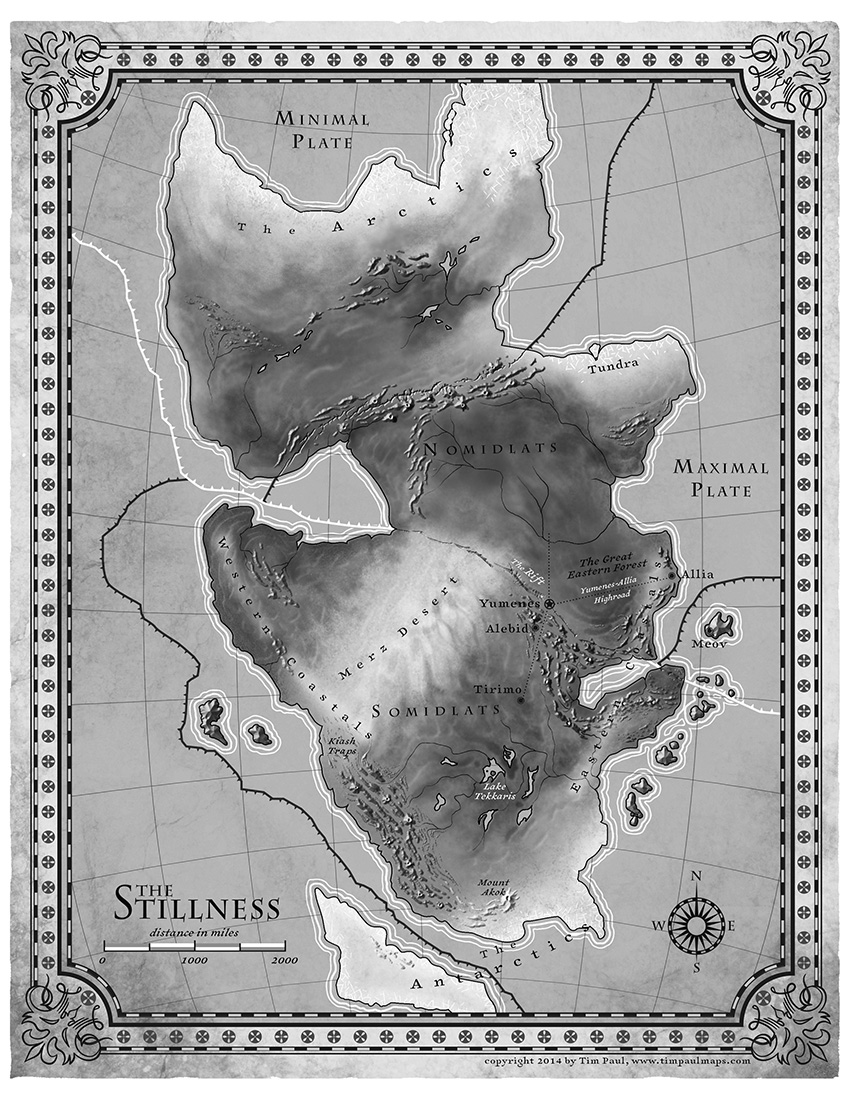 N. K. Jemisin talks about the map that accompanies her new fantasy novel, The Fifth Season. Uncharacteristically for a fantasy map, but appropriately for the novel, it indicates tectonic plate boundaries. Also uncharacteristic is its use of shaded relief to indicate mountains. The map was executed by Tim Paul, whose portfolio is here.
Tor.com is giving away 10 copies of a fold-out poster map that accompanies the boxed set of Brandon Sanderson’s Mistborn trilogy. (Entry deadline is October 9 at noon EDT.)
Jake Hayes is collecting maps from children’s fiction on Pinterest.
At The Funambulist last January, Léopold Lambert discussed the use of cartography in François Schuiten and Benoit Peeters’s 2004 graphic novel The Invisible Frontier (Vol. 1, Vol. 2).
As Fabrice Leroy exposes in “The Representation of Politics and the Politics of Representation in Schuiten and Peeters’s La Frontière Invisible,” (History and Politics in French-Language Comics, Jackson: The University of Mississippi Press, 2008, 117-136), two cartographic paradigms oppose each other throughout Schuiten and Peeters’ novel. The first one is carried by an old man, Monsieur Paul, who is committed to make maps that reflects on the historic conditions of a place, both at an individual empirical level and at a collective (inter)national one. This interpretation of the map is particularly illustrated in the first part of the story with the delicate care of each body interacting empirically with the model/terrain. The second one is also embodied by a character, Ismail Djunov, who undertook to automatize the process of map-making through monumental machines aiming at an objective cartography.
Something else for me to track down. The Invisible Frontier seems to be out of print.
Eleusinian Mysteries
Another fantasy story featuring maps, Charlotte Ashley’s “Eleusinian Mysteries,” appears in this month’s issue of Luna Station Quarterly. In it, a Javanese-Dutch mapmaker named Maghfira is punished for making maps of the moon that include a seemingly fanciful feature: a city named Eleusis. Naturally—this is an sf/fantasy story, after all—Eleusis turns out to be not so fanciful, and Maghfira gets herself into further trouble in its pursuit. The story says a little about maps and forbidden knowledge, rather more about about alienation and the urge to strike out into the unknown.
Real World vs. Fantasy Maps
In my study of fantasy maps, one thing I’m particularly interested in is the difference between fantasy maps and their real-world counterparts. Those differences can be substantial; at some point I hope to go into a bit more depth about them. Meanwhile, James Hinton’s guest post at The Worldbuilding School tries to address this subject by comparing a single real-world city map (London, 1653) with a non-canonical map of Osgiliath from a role-playing game. His point turns out to be that fantasy settings should make sense (Osgiliath, according to the map, doesn’t): it’s a question of geography rather than cartography. The territory rather than the map. But if you begin building your fantasy world by drawing the map … [MetaFilter]
Fictional Maps International Conference
The Fictional Maps International Conference, an academic conference on the use of maps in fiction, will take place from January 21 to 23, 2016 at the University of Silesia’s Scientific Information Centre and Academic Library in Katowice, Poland. Stefan Ekman, the author of Here Be Dragons: Exploring Fantasy Maps and Settings (my review), is the keynote speaker. Deadline for submitting abstracts is October 30.
If you’ve been following along, you will instantly understand that this is very much relevant to my interests, and though it’s been an awfully long time since I’ve been in academic mode, I might have to figure out a way to go to this.