Hyperallergic has a review of Cities of the World (Taschen, November 2015), a reprint of colour plates from Georg Braun and Franz Hogenberg’s Civitates Orbis Terrarum, which appeared in six volumes between 1572 and 1617. From Taschen: “Featuring plans, bird’s-eye views, and maps for all major cities in Europe, plus important urban centers in Asia, Africa, and Latin America, this masterwork in urban mapping gives us a comprehensive view of city life at the turn of the 17th century.” Maps from the Civitates Orbis Terrarum can also be viewed online here and here. [via] Buy at Amazon (Canada, U.K.)
Tag: books
Pocket Atlas of Remote Islands
 Judith Schalansky’s Atlas of Remote Islands first appeared (in English translation) in 2010. Since then it seems to have achieved a longevity few books of any sort manage. A pocket edition came out in 2014. On Wikipedia (of all places) there’s a companion to the book, linking to entries for each of the Atlas’s essays. And just last week it was featured on The Paris Review’s blog. (See also this 2013 interview with Schalansky at, appropriately enough, The Island Review.) Buy at Amazon (Canada, U.K.)
Metropolis: Mapping the City
 Nicolas Crane reviews Jeremy Black’s Metropolis: Mapping the City (Conway, October 2015) for Geographical magazine. “The aim is to explore through time the visualisation of cities, so we start with a terracotta plan of the Mesopotamian holy city of Nippur, in what is now Iraq, then travel through Renaissance cities, New World cities, Imperial cities and mega cities. […] If you’ve ever wondered why cities work, you’ll find the answer in this beautiful book.” Buy at Amazon (Canada, U.K.)
The Railway Atlas of Scotland
 Also from Birlinn, The Railway Atlas of Scotland: Two Hundred Years of History in Maps by David Spaven, which came out last October.
Previously: British Railways, Past and Present.
Glasgow: Mapping the City
 The National’s Alan Taylor reviews Glasgow: Mapping the City by John Moore (Birlinn, October 2015), an illustrated book of maps of the city dating back to the 16th century (via). This is one of several map books published by Birlinn that cover the history of Scotland in maps: previous volumes include Edinburgh: Mapping the City by Christopher Fleet and Daniel MacCannell (2014) and Scotland: Mapping the Nation by Christopher Fleet, Charles W. J. Withers and Margaret Wilkes (2012).
Designing Better Maps Reviewed
 Gretchen Peterson reviews the second edition of Cynthia Brewer’s Designing Better Maps: A Guide for GIS Users (Esri Press, December 2015). “I’d say it’s much better than the previous edition. All the images have been updated and are now in keeping with modern cartography practices. All the typical things that you need to know are covered from fonts and labels to color and layout.” Buy at Amazon (Canada, U.K.)
Gift Guide: Map Books of 2015
At about this time of the year I assemble a gift guide that lists some of the noteworthy books about maps that have been published this year. It’s by no means a comprehensive list, but if someone in your life is just a little bit obsessed about maps (and if you don’t have such a person, why don’t you?), and you’re looking for something to get them, this list might be of use.
Some of these books you’ve seen me blog about before; others I’m mentioning for the first time.
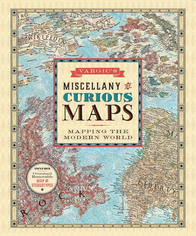
Vargic’s Miscellany of Curious Maps

 In January 2014 a teenage design student from Slovakia named Martin Vargic posted a map of the Internet—inspired, he told The Independent, by the xkcd classic—on his DeviantArt page. The map quickly went viral. Since then, he’s been producing maps of all sorts of things—a revised Internet map, a literature map, historical maps, maps of the world after global warming and an ice age, a stereotype map (see previous entry), plus other infographics—at a dizzying pace, most of which are available for sale on his website. Now his maps are being collected in a book, Vargic’s Miscellany of Curious Maps. It’s out now in the U.K. from Penguin imprint Michael Joseph; in North America it’ll be available in December from HarperCollins. Did I mention he’s a teenager?
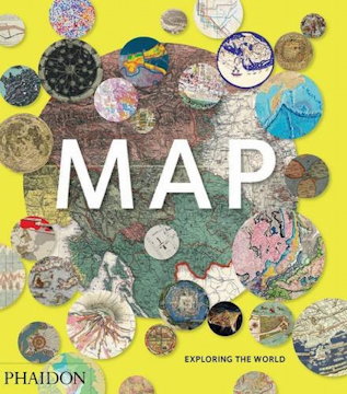
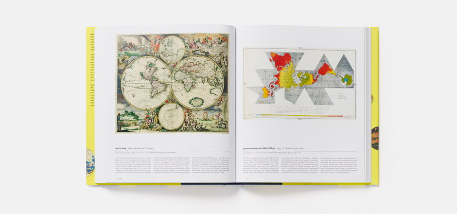
Map: Exploring the World
 The run-up to every holiday season produces a fresh batch of lavishly illustrated map books, and this year does not appear to be an exception. Map: Exploring the World, a collection of “300 stunning maps from all periods and from all around the world,” came out last month from Phaidon Press. The book was assembled by “an international panel of cartographers, academics, map dealers and collectors,” the publisher says; Forbes contributor Bruce Dorminey’s look at this book reveals that one of them was Library of Congress map curator John Hessler.
Atlas of Cursed Places
 The first thing to keep in mind about Olivier Le Carrer’s Atlas of Cursed Places (Black Dog & Leventhal, October 2015) is that it’s not an atlas. Rather, it’s a collection of brief essays about a series of unique places around the world. In that I suspect it’s much like Judith Schalansky’s Atlas of Remote Islands or Aude de Tocqueville’s Atlas of Lost Cities (English translation forthcoming next year). All of these books shared a publisher in France; all of them appear to have been conceived under the influence of Calvino.
The Atlas of Cursed Places’s essays are about places in the world that are, for one reason or another, particularly horrible, by dint of their history or geography. There are navigational hazards and environmental disasters, and sites of old horrors that were entirely human-made. Ghost towns, war zones, slums and mausoleums. Animal infestations. Each are engrossing, but the essays barely get started on their subjects: turn the page expecting more and you find yourself already on the next one. Each essay is an act of cruelty (very meta given the subject matter), whetting readers’ appetites but denying us the feast.
In the end this is an exercise in curation: the choices are fascinating, but the essays are affective rather than substantive. In that sense this book is an even lighter read than Alastair Bonnet’s Unruly Places (which seems to have much less Calvino in its book DNA).
(While not an atlas proper, this book does have a lot of maps illustrating each essay. But their effect is disorienting: each cursed place is indicated by a star on an old and out-of-date map, usually a plate from a century-old atlas.)
I received an electronic review copy of this book from the publisher via NetGalley.
New Edition of Transit Maps of the World
 A revised and expanded edition of Mark Ovenden‘s Transit Maps of the World is coming out in early November, presumably because the transit systems, and the maps thereof, have also been revised and expanded since the first edition was published in 2007. (My review of the first edition is here.) It’s being published by Penguin in the U.S. and Particular Books (a Penguin imprint) in the U.K. [Amazon]
Atlas of Stereotypes
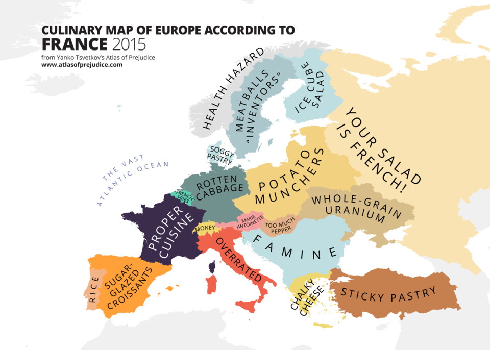
Back when I was doing The Map Room, I followed along as Yanko Tsvetkov started producing map after map of European stereotypes. The project really took off. He’s kept at it since, while I wasn’t looking quite as closely; he’s also collected them into two self-published volumes called the Atlas of Prejudice, which appear to have sold rather well in several different languages. As of July, an all-in-one edition, Atlas of Prejudice: The Complete Stereotype Map Collection, containing all the maps from the previous volumes plus 25 more, is now available.
Previously: Yanko Tsvetkov’s Beloved Europe; Mapping European Stereotypes; Stereotype Maps of the World, Unite!
Mind the Map
 A new book of map art is due out from Gestalten later this month. Mind the Map, edited by Antonis Antoniou, Robert Klanten and Sven Ehmann, seems very much in the same vein as their previous effort, A Map of the World. “Mind the Map is a showcase that reflects the broad range of work now being created by a new generation of mapmakers from around the world including classically legible maps, artistic experiments, editorial illustrations, city views, vacation guides, and global overviews.” The Guardian has some samples, as does the publisher’s catalog page.
Previously: The World According to Illustrators and Storytellers.
Plotted: A Literary Atlas
 Coming in October from Zest Books: Andrew DeGraff’s Plotted: A Literary Atlas, a collection of the artist’s maps of fictional worlds. The Huffington Post has an interview with the author and sample pages from the book, from which we can get a sense both of DeGraff’s distinct and idiosyncratic artwork and the books he chose to make maps for. They’re not necessarily books you’d expect maps for (e.g., A Christmas Carol). These are maps of the stories—not, as we see in fantasy maps, of the stories’ setting—which means a completely different perspective that takes into account both time and distance travelled.
Three Books on WWII Maps
- Great Escapes: The Story of MI9’s Second World War Escape and Evasion Maps by Barbara Bond (Times Books, October 2015): history of the escape maps produced for prisoners of war.
- Mapping the Second World War by Peter Chasseaud (Collins, October 2015): a collection of historical maps; follow-up to Chasseaud’s 2013 book Mapping the First World War.
- Mapping the Second World War: The Key Battles of the European Theatre from Above by Michael Swift and Michael Sharpe (Conway Maritime Press, November 2014).
Previously: Two Books on WWI Maps.


